Wednesday, July 29, 2009

Flight Following ATC conversation

Here is an example conversation I might have with Air Traffic Control (ATC) and Flight Service Station (FSS) while flying under Class Bravo airspace and into Class Charlie airspace and dealing with a Tower and Ground. On this path, I would not typically go through Class Bravo; if I did I would need to make sure I heard the words "cleared into class Bravo" from ATC before entering the airspace. In this conversation, I will open a flight plan, get flight following, communicate with a number of controllers, and land at Colorado Springs Airport which is in Class Charlie airspace. This is from memory, but I think it is pretty close to all communications that would happen.

You can read my thoughts on flight following in my other VFR flight following blog post. I think it is a great service that everybody should use on cross countries.

Here are some other articles to check out:

http://av.mdickinson.com/articles/flight_following.htm
http://answers.yahoo.com/question/index?qid=20090324185928AALFv7m
http://answers.yahoo.com/question/index?qid=20090429190527AAg6XDh


Call FSS and activate flight plan
Tune Freq 122.4
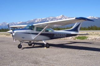
Me: Denver Radio, Skylane 9699G, listening on 122.4, ready to activate my flight plan to Colorado Springs
Denver Radio: Aircraft Calling 122.4, standby, number 2
I often have to wait my turn to talk with FSS.

Denver Radio: Aircraft calling 122.4, say request.
Me: Denver Radio, Skylane 9699G, ready to activate my flight plan to Colorado Springs 15 past the hour
Denver Radio: 9699g, Flight plan to Colorado Springs activated, Local altimeter setting at Metro is 3002. contact flight watch on 122.0, pilot reports appreciated

Me: 3002 for 9699g, thanks.
Ask for ATC frequency if I do not know it.

Get VFR Flight Following
Tune Freq 126.1
Me: Denver Approach, Skylane 9699g, south of Longmont, VFR request
Denver Approach: Skylane 9699G , Denver Approach, say request
Me: Denver Approach, Skylane 9699g, 6,500 south of Longmont, request flight following to Colorado Springs
Denver Approach: Skylane 9699g Squawk 0432, ident
Tune Transponder and hit the ident button. No need to respond if he indicated to ident. Otherwise repeat back.
Denver Approach: Skylane 99g, Radar contact, 10 miles north of Metro airport, altitude 8,500, altimeter 3002
Me: 3002 for 99g

Maybe in the middle sometime, there will be a report of trafic.
Denver Approach: Skylane 99G, Traffic 10 oclock, 7500, 5 miles, north bound
Me: 99G looking for traffic
5 miles out is a ways to see a small plane. If they get closer, you will probably see them. If they get closer, ATC will mention again probably and suggest vectors to avoid the other aircraft if it becomes a concern.

Denver Approach: Skylane 99G, contact denver approach on 128.45
Me: 128.45 for 99g, thank you.
Tune Freq 128.45
Me: Denver Approach, Skylane 9699g, level 8500
Denver Approach: Skylane 99g, Denver Approach, altimeter 3002
Me: 3002 for 99g

Me: Denver Approach, Skylane 99g climbing to 9,500
Denver Approach: 99g, Denver Approach, roger

Denver Approach: Skylane 99G, contact Springs approach on 118.5
Me: 118.5 for 99G, thanks
Tune Freq 118.5
Me: Springs Approach, Skylane 9699g level 9,500
Springs Approach: Skylane 99G, Springs approach, altimeter 3004
Me: 3004 for 99G

Listen to ATIS on second radio. Or ask Springs approach to go off frequency to listen to it.
Me: Springs Approach, Skylane 9699g request to go off frequency to listen to ATIS
Springs Approach: Skylane 99G, frequency change approved, report when back on frequency.
Listen to ATIS
Me: Springs Approach, Skylane 9699g back on frequency. Have information India.
Springs Approach: Skylane 99g, roger

Springs Approach: Skylane 99g, contact Springs tower on 119.9
Me: 119.9 for 99g, thanks
Tune Freq 119.9
Me: Springs Tower, Skylane 9699g, 9,500 inbound full-stop with India
Springs Approach: Skylane 9699g, Report 5 mile final
Me: Report 5 mile final for 99g

Me: Springs Tower, Skylane 99g, 5 mile final
Springs Tower: 99G, cleared to land 17 Right
Me: Cleared to land 17 Right, 99G

Springs Tower: N9699g, turn right first taxiway, contact ground point 7
Me: Contact Ground point 7 99g

Tune Freq 121.7 (Ground point 7)
Me: Springs Ground, 99G at Alpha 2, Taxi to the Jet Center
Springs Ground: 99g taxi to parking via alpha 2
Me: Taxi via Alpha 2, 99G
Find a spot to park and look for a line person if they appear to help with parking.
I usually close my flight plan after landing on my cell phone through FSS.

Discontinuing Flight Following

After using flight following and landing at a Class B/C/D airport, change Transponder to 1200 after landing or at least before leaving. If going to a non-towered airport, you will likely be told to change to 1200 in the air approaching the airport. You can request to cancel advisories as well so that you can change frequencies to the local airport.

Longer Cross Countries

Longer distance travel will not be much difference. Actually it is likely to be easier and more relaxing. In general, all there will be is a new freq maybe every 1/2 hour or so.


That is mostly it. So that will give you an idea of what to expect and what to say.

/Brian

Friday, July 24, 2009

VFR Flight Following

Using VFR flight following with Air Traffic Control (ATC) is great for small and large planes in VFR. I heard about it when I had my private pilot lessons, but never used it with my instructor. My first time using it was on my own. It made me nervous the first time, but it went smoothly and ATC was very nice. Each time it got a bit easier because you know what to expect. Now I use it frequently, and I think everybody should.

I found this web site which details the use of flight following pretty well. If you have not tried flight following yet or want a refresher, I recommend reading that web site.

Why Use Flight Following?

Flight following is great for many reasons, and I highly recommend it to all for cross countries or transitioning Class B or C airspace. Here is one web site that states nine reasons to use Flight following. AOPA Air Safety Foundation recommends instructors to teach their students about flight following now.

There is a web site on AOPA that answers some questions about VFR and IFR ATC communication. I just asked a few new questions to that web site, and I am curious to how long it takes for the question to get answered. There are a number that are already answered on there.

My Good Things about Flight Following

I find that flight following brings extra confidence from your passengers that are listening. They like to hear that you are talking to controllers and that you are on somebody's radar. Most non-aviation people are surprised that you can fly around without talking to ATC. Although, flight following is still not as practical for a local sight-seeing flight.

Flight following is good for helping spot nearby traffic. Sometimes the traffic that ATC will point out will be pretty far away and not easy to spot; some will be closer and important to find. If you can't spot them, ATC will often give you a vector to help with spacing to the traffic.

Flight following is good if anything happens in an emergency. You are still the pilot and the only one in the plane, but they will help where they can. AOPA has a short article and sound recordings of some emergencies where ATC helped; controllers are given a special Archie League Medal of Safety Award for this. If you do emergency land, help would start immediately to find you instead of waiting until your flight plan expires, and they would closer where you landed.

You can ask a little about weather (although FSS is more for that). Sometimes they will comment about weather head or near your vicinity. Controllers have something similar to XMweather available to them if they are not too busy.

Flying through and near Class B, C, D is easier with flight following. They coordinate your handoff and the controllers are expecting your call. Make sure you hear the words "Cleared into Class Bravo" before going into actual class Bravo airspace. If you think you will hit it and are not officially cleared, asked ATC. They will likely give you the clearance or ask you to turn a little to avoid it.

Flight following has the positives of IFR of talking with ATC, but is much more flexible because the flight path is under your control.

Practice with using flight following also will give you a jump start to working on your IFR rating. A lot of using the IFR system is getting used to talking with ATC while flying the plane.

If you might transition to an IFR flight plan, it expect it can make it easier to transition to an IFR flight plan. You can certainly go the other way to from IFR to VFR flight following.

Lots of good things about using flight following.... That is what I can think of quickly.

Higher Altitudes Sometimes Needed with Flight Following

With flight following, you may have to climb higher in some areas than you want. In the mountains, it depends on where radar is and what altitudes it can see airplanes. It varies depending on the area. Around Eagle/Vail and Rifle, there is radar to the ground. If near Gunnison or Alamosa, you have to be something like 13,000 or higher. In these situations, I like doing a VFR flight plan with Spot Tracking as described in my blog.

Other Notes

It is best to do VFR flight plan in addition to flight following. This also helps as a backup plan if ATC does not have time or need altitudes higher than you want.

At one point in the beginning I was nervous about how to switch frequencies for talking with FSS. It is much easier that I thought back then and is usually no big deal. Switching frequencies for weather or PIREP ok. Just ask the controller. If they don't want you to swith right now, they likely can do it in a couple minutes or after the next controller handoff.

Giving PIREPs is useful for lots of reasons and AOPA has a course to talk you through Pireps. I maintain a list of items that are asked for in PIREPs and prepare ahead of giving the PIREP so that I can give them quickly and easily over the radio. The Skyspotter course gives you a list you can use or modify.

Flight following sounds like a lot of radio communication when in Class Bravo, but minimal will be for you. Away from dense airport areas, the radio communication is usually minimal overall for everybody. ATC is very friendly and is use to different levels of experience. Practicing a little ways outside of Class Bravo first can be a way to get your feet wet. None of the Class Charlies I have been in have been very hard so that would be another place to start. You can also glance at my comments about how to get comfortable with talking with ATC. Most of the web accessible controller communication is for busier airports, so the aviation band scanner may be the better way.

Controllers are here to help the pilots. First IFR traffic, then VFR traffic. They would not have jobs if we were not here or did not use them. So all the controllers I have talked with personally say they try to be very accomodating to all pilot requests.

Summary

I plan on following this up with another blog post about an example flight following conversation. Look for it soon. Hopefully, it will answer questions on typical radio communication. It is something that I wish I had when I started, so I will write it down soon.

Everybody should use flight following on cross country trips if possible. If you don't use it yet, make a promise to yourself to try it out.

/Brian

Wednesday, July 15, 2009

Some Mountain Flying Thoughts

Winter Park Aerial Panorama
Recently, a reader asked me for some of my thoughts on flying in the Rocky Mountains with a small plane such as the Cessna 182. The best thing you can do is fly near one of these areas and get some specialized instruction. Most airports around Denver have flight instructors available for mountain instruction. I am not an instructor (at least not yet), but I have some experience of the mountains. Here are some of the big things I can think of from lessons I have had and some of the books I have read. Once again, the best thing is to find an instructor in one of these areas for the specialized instruction.

Before taking instruction or the next best thing to instruction is to read a book about Mountain flying. Here is a link to some books on Mountain flying. Sparky Imeson's mountain flying book is a standard for reading on the subject. There are also good tips on Sparky's web site. Some of those web pages are more focused for backcountry mountain strips. Here is a minimum mountain flying knowledge page. If you become interested in backcountry strips, I would recommend taking a class such as the ones offered by McCall Mountain/Canyon Flying Seminars. I took the basic course and wrote about this great mountain/canyon flying seminar in the past.


Landing
  • Make sure you richen your mixture somewhat before landing. I do 5 half turns rich of my cruise mixture, but not full rich. Full rich and too lean is not good at high altitude. This method gives you appropriate power for a go-around if needed.
  • Land with short field techniques with smooth stabilized approach/descent. Don't chop the power on short final if you would land too long. Go around and try again.
  • Ground speed is faster landing at high altitude, it looks different, but keep same airspeed. This is due to larger indicated vs true airspeed difference at altitude.
  • Do not land too fast. Fly the speeds in the POH. Very important at high altitude. Landing fast will cause you to float and use a lot of runway distance.
  • Don't land two slow either; you do not want to stall.
  • Colorado airport information is available on-line on the CDOT web site.


Takeoff
  • Lean during runup. Find where leaning mixture drops RPM. Then richen 5 half turns
  • Takeoff with short field techniques
  • On takeoff reach 70% of take off speed 1/2 way down the runway, if not abort. Wind, weight, temperature, pressure altitude or something is causing problems.
  • Be 10% or more under gross weight. Reduced weight greatly helps your takeoff distance. Don't fill tanks all the way if at a high altitude airport
  • Your manifold pressure at takeoff will be much lower and the wings/prop develop much less lift. You can simulate the manifold pressure difference at your airport. A 29.92 day at 10,000 feet, I think would be about 19" Manifold pressure at takeoff
  • Likely the temperature will be much higher than standard as well which will greatly affect things and cause a very high density altitude. Taking off from Leadville in the middle of the day in the summer is a bad idea.
  • Check your takeoff distance in your POH, but realize your distance will possibly be much longer due to not being a new plane and not being a professional test pilot.

Climbout

  • Climb out after take off, fly the POH airspeeds. Your pitch and climb rate will be much slower, but this is normal.
  • Watch your rudder control; step on the ball during the climb. Coordinated flight will help increase your vertical climb rate and is safer.
  • Don't let your speed drop too low trying to maintain a positive climb rate and stall
  • Watch for clearing obstacles when climbing out. Circle if you need to.
  • Lean your mixture appropriately. The 5 half turns rich works pretty well for me to start. Then afterwards I do it according to fuel flow mentioned in POH. I have a Fuel Flow meter. The fuel flow is about right for the EGT to be about 250+ rich of peak. Too lean is not good too. Detonation can happen and cylinder temps can get too high.
  • Keep cylinder temps 390 degrees or lower. Level off, gain speed, and richen mixture to lower cylinder temps
Crossing Ridges

  • Be careful crossing ridges. Approach at 45 degrees when close. Maybe within 1 mile. If you approach at 45 degrees, you will have only 90 degree turn to go back to lower terrain If you are further away from the ridge, you can probably afford a full 180 degree for lower terrain.
  • Downdrafts can be subtle or severe in the mountains. I have usually seen subtle ones which are still a problem. You get down to Vy and you still can't have positive climb rate. Make sure you are at max RPM max throttle. 2600 RPM in my C182P.
  • If in a severe downdraft, turn around in the direction of lower terrain.
  • If in slight downdraft, try near opposite side of the valley, if one side is in down draft, sometimes other is in slight updraft. Otherwise, go further away from pass and try climbing before approaching pass.
  • If having difficulties climbing, but not in a downdraft, you can step climb. Level, gain speed, then climb a bit, level, gain speed, then climb, repeat.
  • Always plan an alternate to crossing your intended pass. A different pass or another day. Or possibly stop and rent a car for the last portion of the trip.
  • Turbulence as you get closer to ridge is probably a sign to not cross the ridge here or today. Some is expected, but severe turbulence is definitely a warning. Likely bad downdrafts as you get closer. Flying higher can help.
  • 20+ knots predicted winds aloft at 12,000 is a concern. 30+ is probably a no go. Sometimes the Mountain AWOS will be indicating 30+, but it can be ok if it is not too near you. But be careful.
  • One side of the valley or ridge is usually smoother than the other due to winds. Sometimes it is dramatic.
  • I usually cross 1000-2000' over the passes. Especially when my wife is with me and when I was new. That will put me 12,500+ over many of the passes and then I drop down after the pass to under 12,500.
  • My 7-year old son gets airsick easier at higher altitudes, so I try to descend when possible.
  • If you have Garmin 430 Waas, the altitude reported on the Terrain page is accurate. I have found this is better than using the Altimeter setting from the airport. Usually you are higher than what the airport altimeter setting would tell you. The altimeter setting will vary around the pass and a mountain AWOS will tell you a pretty high setting which is valid only for the pass.
  • Mountain AWOS are good for wind and cloud reports. But it can be reasonably clear at the pass with clouds backed up on the other side.
  • Also watch that you can see more and more terrain on the other side as you approach a pass. This ensures you are currently higher than the pass.
  • Fly the main passes and then down the valleys. See my other blog entry for some suggestions on VFR Paths over the Rockies. It won't be a GPS direct course, but you usually can make some GPS waypoints that are relatively close to what you want to fly. Fly it with a Sectional Map and watch very carefully where you are and where the nearest airport is. There is a sectional of Colorado with passes marked at the CDOT website.

Other General Items

  • Portable oxygen is good at altitude if possible especially for a flatlander. Maybe borrow one? I use it if I am going to be at 12,500 or higher for a long trip, and I live at 5,000. It keeps you thinking clearly and prevents headaches. Remember to refresh your memory on the oxygen altitude requirements.
  • Manifold pressure goes up as you descend. This can be strange when you are reducing power and trying to lose altitude. You set it at 15", descend 2000' and MP is now at 17" without moving the throttle. You need to keep reducing the throttle a little as you go lower in altitude to maintain 15". Make sure cowl flaps are closed as you descend.
  • Always have an out. Know where lower terrain is. Plan so that you don't have to go over the pass. Stay a night somewhere and wait for a better day. Plan for a different way around even if it adds 2 hours. Always be able to turn to lower terrain. Land and rent a car for the last portion of the trip.
  • Avoid IFR in the mountains
  • Avoid night flying in the mountains
  • Carry survival equipment in the case of emergency. Sleeping bags or lots of space blankets, first aid, etc.
  • I use a SPOT Satellite Messenger for emergency notification and tracking as indicated in a past blog. A Personal Locator Beacon is another good way to go.
  • File a flight plan and get flight following if possible. Flight following is not possible in most mountainous areas though.
Instructors or others out there... Did I miss any big items?

/Brian

Friday, July 3, 2009

Teton Flying Trip: 2009

We had another beautiful flying trip with my wife and son to the Grand Teton National Park last week. We followed what I wrote in my blog a while back for a future Yellowstone/Teton trip idea.

Here is our flight path up to the Tetons and back through use of the SPOT Satellite messenger as mentioned in my previous blog. SPOT also now has a new web site called Spot Adventures that I am trying out. It enables you to do a story with pictures linked to your SPOT GPS track. By the way, it looks like SPOT is having a special offer for free SPOT trackers if you sign up for the service for 2 years.

KLMO KJAC SPOT route

Getting There

The path up from KLMO was not quite as pretty as we hoped for. It was cloudy most of the way. Our route was basically KLMO-KLAR-U25-KJAC.

Tetons from the ILS 19 KJAC approach

We ended up filing IFR for the last portion. Here is a picture of our track in FlightAware.

KJAC IFR ILS 19 June, 2009

Arriving in Jackson Hole

We flew into the Jackson Hole Airport (KJAC), rented a car through Hertz with the Jackson Hole Aviation FBO rate. Their rate ($48/day) was better than Expedia.com and they were extremely helpful and had our car waiting at our plane's tie down spot. Make sure you reserve a tie-down spot with them. They typically have only 20 spots, and right now only 5 spots due to some planes relocated from the Driggs Airport. It also gets you the good treatment with the rental car and parking. There was a $5 landing fee and $10 per day tie down fee. Gas is a little expensive, but it is worth it due to the location. We then drove up to Colter Bay on Jackson Lake in the Grand Teton National Park and stayed in one of the Tent/Cabins.

Colter Bay and the Tent Cabin

Colter Bay Tent/Cabin

The Tent/Cabin was quite nice, but rustic; it has a wood stove. We chose these since we wanted something like tent camping, but you can't reserve a tent site in advance. It was $48/night. The bathrooms were down the hill and the showers were available for $3 in the Laundry/General Store area. Some of our friends reserved the normal cabins which were nice too.

Here is a picture from the air I took on a previous trip. The area has tent/cabins, regular cabins, regular camping, a marina, restaurants, and a general store. It is well laid out in the trees and areas are separated, so you do not know how big it is from the ground.


Colter Bay Aerial Photo

The restaurant, cafe, and general store were pretty nice with good prices. The menus are on-line for the restaurant and cafe. We also bought things from the deli at the general store and ate a the nearby picnic tables a number of times. Much better prices than the Yellowstone area.

The first day we went to Old Faithful which we missed on our last visit to Yellowstone and my son really missed.

Old Faithful

The next day I did some sunrise hiking around Colter Bay and then a visit to the town of Jackson in the evening.

Tetons from Colter Bay Marina

The next day all three of us got up for sunrise pictures and wildlife searching. We saw a nice sunrise and some wildlife (Bison, Antelope, Otter, Pelicans, Elk, Deer, but no Moose). We hear moose are usually near Moose Junction, but we weren't lucky in seeing them. There is a Chuckwagon dinner in Moose Junction that looks interesting, but the chuckwagon special dinner is not on every night and we missed it. We also went to Jenny Lake, took a boat across the lake and hiked the rest of the way to Hidden Falls (0.5 miles each way). Lots of fun stuff!


Getting Back

Some thunderstorms passing through in the morning near Jackson, but otherwise great weather. Pretty scenic flight around the Tetons before heading south. Just fly 2000' AGL or higher since it is a National Park and no closer than 2000' from the mountains. I told Jackson Tower what I wanted to do and they were very accomodating.

Tetons Aerial Photo

Then a pretty flight over the Wind River Range. Then home.

Wind River Range Aerial Photo

Our approximate path was KJAC-KPNA-LAR-KLMO.

/Brian