Showing posts with label trips. Show all posts

Monday, November 18, 2013

Jackson Hole Hoback Canyon

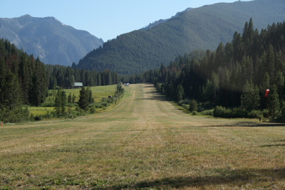
Last time I went to Jackson Hole, I went by a slightly new path.  It was a pretty good one and I found some points to plug into the GPS to make it easier.  The route follows what I have heard is called Hoback Canyon.

I have had a number of people ask me about getting to Jackson Hole, Wyoming and the Tetons.  So I thought I would write about this path.  If you are ever thinking about this trip, I highly recommend it.  I have talked about it on a number of blog posts.  My Teton Flying Trip in 2009 was the last time I wrote about it.

Hoback Canyon Route

The route is:
KPNA TUVOC JAGIL ZUGEN KJAC


Here are some altitudes of interest that I looked up:
The Jackson Hole Airport KJAC is at at 6451' MSL.
The Bottom of the canyon is about 6500' MSL, and there looks to be about a 2.5 mile width at about 8000'.
The floor between KPNA and TUVOC is about 8000' MSL and you want to fly a decent altitude above that.

There are lots of big mountains around, so pick an altitude that is best for you, your plane, the winds, and the weather.

The East Route

Here is a route from the east which is also a nice route.
RIW KDUB DNW KJAC

This route has a higher pass which you need to clear with common Mountain Flying practices in mind.

Mountain Flying Principles

Here is one page that talks about some mountain flying principles.  I have his book and try to grab every book I can find on Mountain Flying and get instruction and thoughts from people whenever I can.

When to Fly

I have always flown up to Jackson and the Tetons in the summer.  This prevents any worry about snow storms or how to keep my plane out of the weather.  Spring or Fall could be ok too, but it does get colder than you think in the Tetons in the Spring/Fall.  That has been my recommendation for people.

Flying into a ski town for skiing sounds like fun, but I have never done it.  I think it is safer to drive unless you get lucky with the perfect weather, especially if you are considering staying overnight.


/Brian

Wednesday, April 7, 2010

California Flying Trip 2010

I just got back from our yearly spring break trek to California from Colorado. It has been a fun destination for us in the past in 2006 to San Diego, 2007 to Carlsbad, 2009 to Disneyland. And it was fun again this year both for the flying route and the visiting in San Diego.

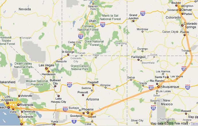
Below is my track on this year's California trek using the method I described in a past block entry using my Spot Satellite messager. The route between KHII and KCRQ is missing below, but I will describe it further below.


The flying back and forth was similar to past years. It seems we typically have good weather on the way out, and then have weather to divert around on the way back. The one difference this year was that the marine cloud layer in San Diego was not around on departure or arrival, so IFR was not required. If we had arrived or left on any other days, we would have had the clouds, but not on our days.

We break our path each direction into three pieces. Two pieces done in the first day, and then we leave the last short piece for second day.

Getting there: Day 1

Starting off, we had to wait a day before leaving due to weather. But this worked out. We had an extra day to get ready and plan. The weather also left behind a nice blanketing of snow on the mountains for our route. Very pretty!

Our starting path between Longmont, CO and Page, AZ was roughly by klmo-dobee-funds-kege-kpga and weaving over Rollins Pass and through valleys and over Vail Pass. Along the way we looked at Breckenridge, Copper, Vail, and Beaver Creek ski areas.

Page, AZ (KPGA) is a great place for a inexpensive fuel stop and picnic lunch. The view on the approach over either Lake Powell or Grand Canyon are incredible. The view from the ramp is pretty nice too.

Page Arizona Airport Ramp

Our next path from Page, AZ to Lake Havasu, AZ was roughly by kpga-kgcn-khii and following some of the Grand Canyon cooridors as described in my earlier post.

In more detail, I went from kpga to Zuni north, Dragon north, Dragon south to khii. I went ahead and made waypoints in my GPS and followed that flight path. I also watched my altitudes so that I am in compliance with the needed altitudes in the Grand Canyon area. Basically 8500' initially, and then up to 10,500' when got closer to the Zuni North Corridor point. See the Grand Canyon chart on-line at skyvector.com and click the Grand Canyon VFR button.

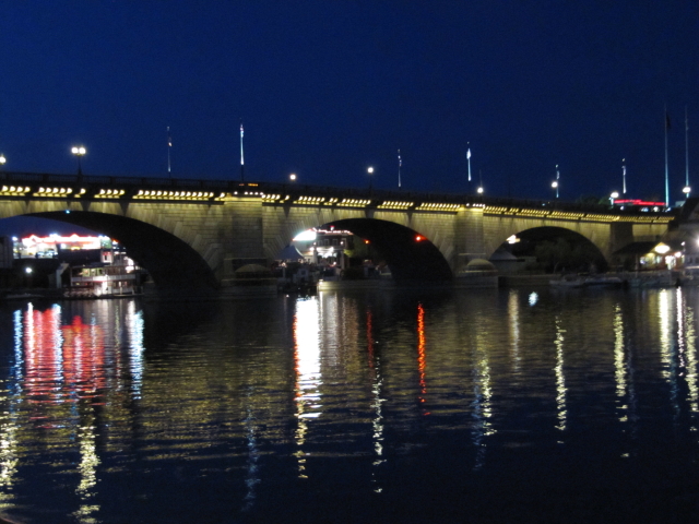
Desert Skies FBO in Lake Havasu (KHII) was very helpful and had a wonderful free slushy machine. We stayed at the Travelodge at Lake Havasu; it was ok. We heard that the Desert Skies FBO had a deal on the Hampton Inn for $89 and we might try that next time. We found a nice beach/park area to park and walk around near the London Bridge; this part is worth looking around more next time.

London Bridge at night

Getting there: Day 2

For getting in and out of the San Diego area and just in case of a marine layer, I filed IFR. I received the following clearance: khii-tnp-v208-ocn-kcrq. In the end, I did not have to go to OCN and flew this route: khii-tnp-trm-jli-escon-kcrq. The Western Flight Services FBO at Carlsbad/Palomar Airport (KCRQ) greeted us and was very helpful and nice. We selected KCRQ since they had the best deal on rental cars ($33/day) and KCRQ was still convenient to San Diego.

Visiting San Diego

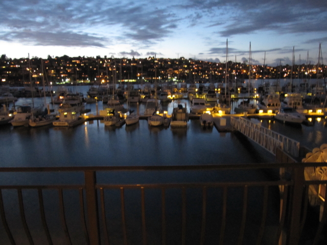
We found our hotel by searching on tripadvisor.com and clicking the best deals button. We ended up at the Best Western Island Palms Hotel on Shelter Island ($123/night including taxes); it was very nice!.

Island Palms balcony view

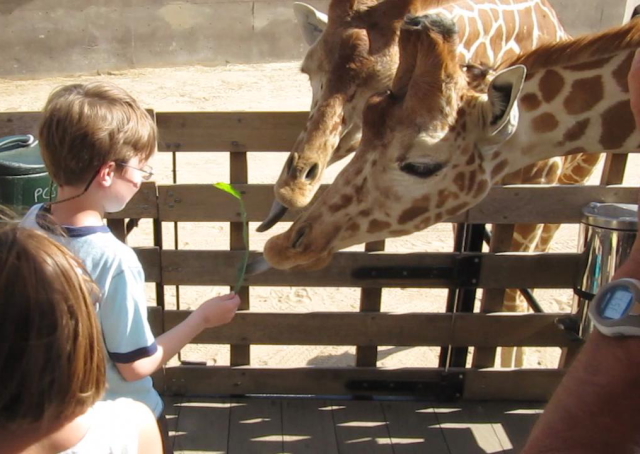
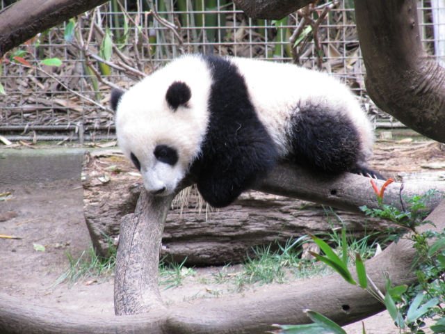
This trip, we visited the San Diego Wild Animal Park and fed the giraffes on the Photo Caravan Tour. The next day was San Diego Zoo. Then we visited the La Jolla seals. Then Cabrillo National Monument. Then it was time to head home. The highlights of the trip were feeding the giraffes and the pandas.

San Diego Wild Animal Park Photo Caravan

San Diego Zoo Panda

Coming Back: Day 1

Snowy weather was in the mountains of Colorado and expected to stay there for a while, so we plotted our path towards the Albuquerque/Santa Fe area. This works well when the mountains are snowed in.


I filed IFR to get out even though it was clear. I ended up receiving this clearance: kcrq-ocn-jli-shadi-blh-v16-pxr-kffz. I did not quite fly to OCN at the beginning and Luke AFB approach sent me on the 100° radial of the BXK VOR. So in the end I flew this path between KCRQ and KFFZ.

Falcon Field (KFFZ)in Phoenix has cheap fuel and good food. We ate at the Anzio Landing Italian restaurant on the field like we did last year, and it was very good again. We did the self serve gas and that worked well too.

Our last path for this day was a straight shot to Santa Fe: kffz-ksaf. There was clouds, nearby snow, and wind at Santa Fe when we left Phoenix, but it cleared out about a 1/2 hour before we got there. This took some planning and required some backup plans.

Santa Fe Air Center FBO in Santa Fe (KSAF) was very nice and helped us with parking and a hotel. In the end, we bought fuel at the self serve pumps on the other side of the tower, but this was fine with them and did not change the service. We stayed at Courtyard Marriot for $75 using the FBO. It has an indoor pool and some restaurants near by and a shuttle back and forth to the airport. It was a ways from downtown, but we heard there was a bus that went into town. We might have to come back to Santa Fe again and try this.

Coming Back: Day 2

Our last part back was approximately ksaf-1v8-larks-klmo, but stayed east of the course along the west side of sangre de cristos then over hayden pass.

Possible Return Path Next Time

There is another similar return path I want to possibly try next time. Phoenix and KFFZ is nice, but for something different, we might try Sedona (KSEZ) next time as a lunch break on a southern route. Sedona is beautiful, fuel appears to be reasonably priced, and it appears there is a restaurant on the Sedona field. Maybe we will do a path like this next time between KCRQ and KSAF: kcrq-ocn-jli-trm-pke-ksez-ksaf.

I am not sure how Bagdad 1 MOA between pke and ksez would be if filing IFR if flying Mon-Fri when active. It seems like you could fly below it since the bottom is 7000'MSL or 5000'AGL whichever is higher. But would ATC give it to you since there is no airway and it might depend on the Minimum IFR altitude in that area. You might get the following between KCRQ and KSEZ which is still not too bad: crq-ocn-jli-trm-tnp-jotnu-zelma-eed-drk-sez

Summary

Once again the Colorado to Southern California trip is a winner. A recommended trip if you are in the Colorado area.

/Brian

Friday, January 15, 2010

States Travelled maps

Sometimes it is fun to look back and see what places and states you have flown your airplane to. I have used two different methods to look back in time.

This is also the time of year that I start thinking about long flying trips for the rest of the year. These maps can help me think of new places to fly and help me remember some of my old favorites.

OurAirports.com is a site dedicated to aviation and actually has the ability to list comments on airports. It can also be used for people traveling as passengers in airplanes.

Here is my map from this website:


Here is another more generic site for generating a map of states that you have been.

Here is my map using this method:
States Flown to

For me, it is definitely a little bit lopsided near where I live. Lots of places left to explore, especially in the East and Northwest.

/Brian

Friday, July 3, 2009

Teton Flying Trip: 2009

We had another beautiful flying trip with my wife and son to the Grand Teton National Park last week. We followed what I wrote in my blog a while back for a future Yellowstone/Teton trip idea.

Here is our flight path up to the Tetons and back through use of the SPOT Satellite messenger as mentioned in my previous blog. SPOT also now has a new web site called Spot Adventures that I am trying out. It enables you to do a story with pictures linked to your SPOT GPS track. By the way, it looks like SPOT is having a special offer for free SPOT trackers if you sign up for the service for 2 years.

KLMO KJAC SPOT route

Getting There

The path up from KLMO was not quite as pretty as we hoped for. It was cloudy most of the way. Our route was basically KLMO-KLAR-U25-KJAC.

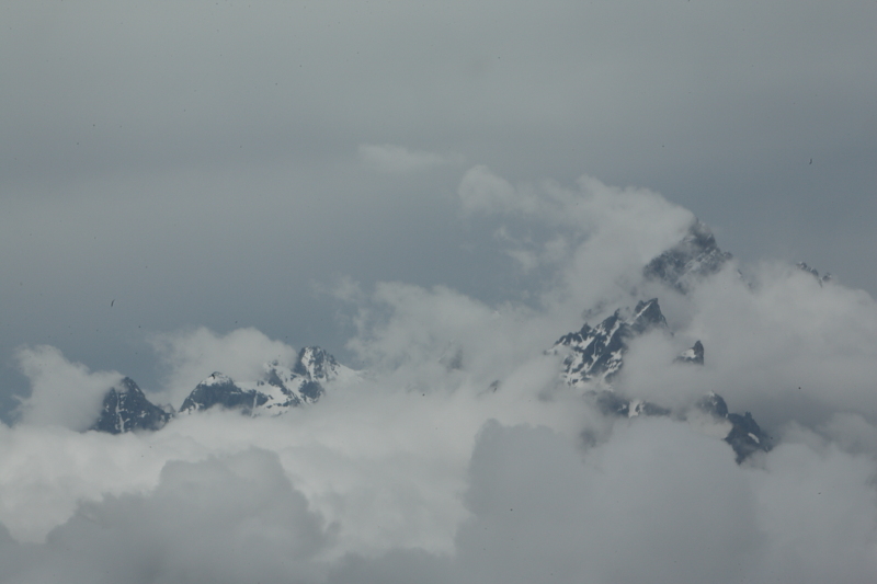
Tetons from the ILS 19 KJAC approach

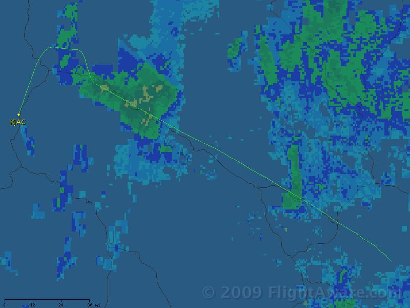
We ended up filing IFR for the last portion. Here is a picture of our track in FlightAware.

KJAC IFR ILS 19 June, 2009

Arriving in Jackson Hole

We flew into the Jackson Hole Airport (KJAC), rented a car through Hertz with the Jackson Hole Aviation FBO rate. Their rate ($48/day) was better than Expedia.com and they were extremely helpful and had our car waiting at our plane's tie down spot. Make sure you reserve a tie-down spot with them. They typically have only 20 spots, and right now only 5 spots due to some planes relocated from the Driggs Airport. It also gets you the good treatment with the rental car and parking. There was a $5 landing fee and $10 per day tie down fee. Gas is a little expensive, but it is worth it due to the location. We then drove up to Colter Bay on Jackson Lake in the Grand Teton National Park and stayed in one of the Tent/Cabins.

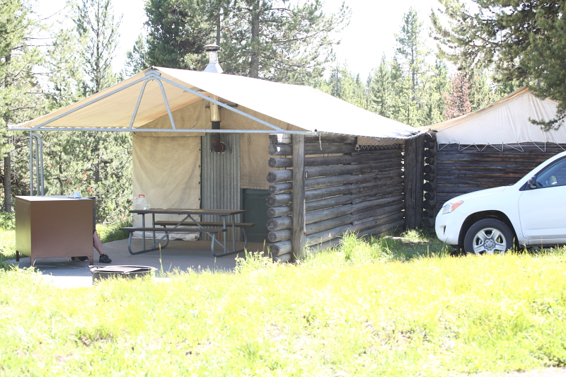
Colter Bay and the Tent Cabin

Colter Bay Tent/Cabin

The Tent/Cabin was quite nice, but rustic; it has a wood stove. We chose these since we wanted something like tent camping, but you can't reserve a tent site in advance. It was $48/night. The bathrooms were down the hill and the showers were available for $3 in the Laundry/General Store area. Some of our friends reserved the normal cabins which were nice too.

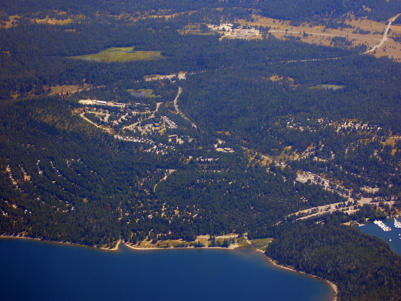
Here is a picture from the air I took on a previous trip. The area has tent/cabins, regular cabins, regular camping, a marina, restaurants, and a general store. It is well laid out in the trees and areas are separated, so you do not know how big it is from the ground.


Colter Bay Aerial Photo

The restaurant, cafe, and general store were pretty nice with good prices. The menus are on-line for the restaurant and cafe. We also bought things from the deli at the general store and ate a the nearby picnic tables a number of times. Much better prices than the Yellowstone area.

The first day we went to Old Faithful which we missed on our last visit to Yellowstone and my son really missed.

Old Faithful

The next day I did some sunrise hiking around Colter Bay and then a visit to the town of Jackson in the evening.

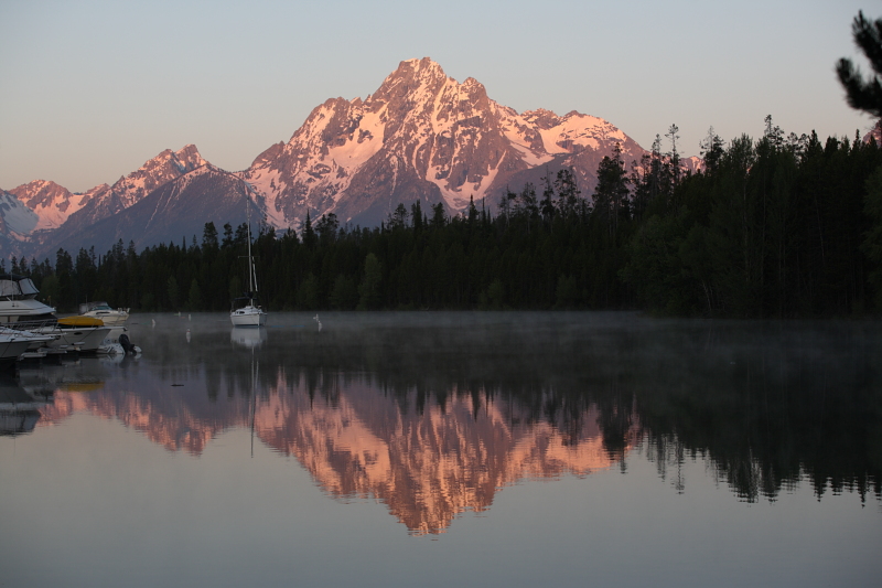
Tetons from Colter Bay Marina

The next day all three of us got up for sunrise pictures and wildlife searching. We saw a nice sunrise and some wildlife (Bison, Antelope, Otter, Pelicans, Elk, Deer, but no Moose). We hear moose are usually near Moose Junction, but we weren't lucky in seeing them. There is a Chuckwagon dinner in Moose Junction that looks interesting, but the chuckwagon special dinner is not on every night and we missed it. We also went to Jenny Lake, took a boat across the lake and hiked the rest of the way to Hidden Falls (0.5 miles each way). Lots of fun stuff!


Getting Back

Some thunderstorms passing through in the morning near Jackson, but otherwise great weather. Pretty scenic flight around the Tetons before heading south. Just fly 2000' AGL or higher since it is a National Park and no closer than 2000' from the mountains. I told Jackson Tower what I wanted to do and they were very accomodating.

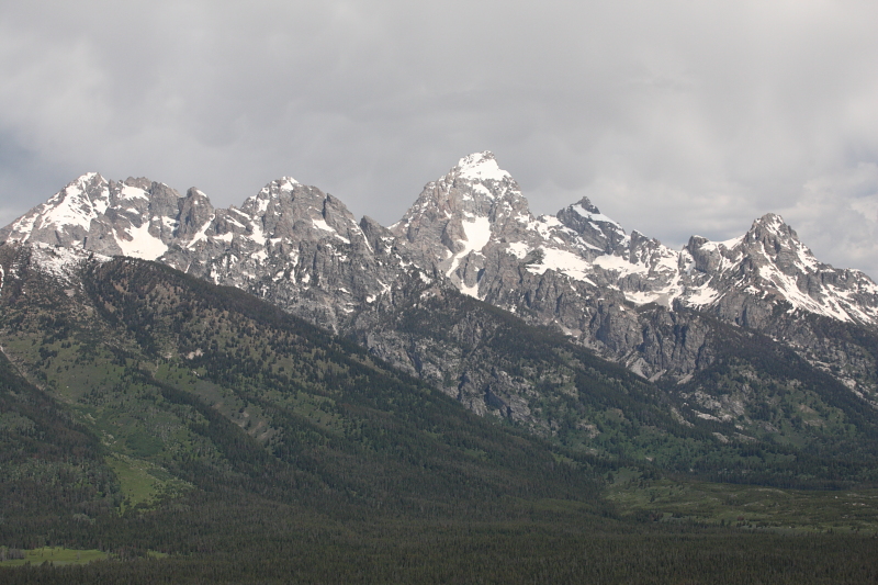
Tetons Aerial Photo

Then a pretty flight over the Wind River Range. Then home.

Wind River Range Aerial Photo

Our approximate path was KJAC-KPNA-LAR-KLMO.

/Brian

Thursday, June 4, 2009

Dakota Thunder 2009

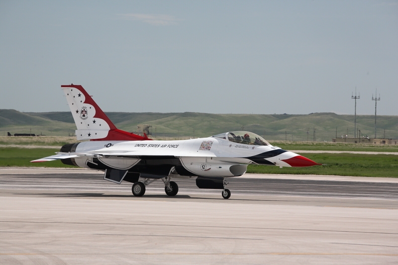
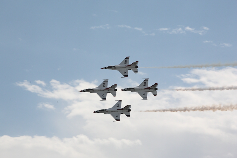
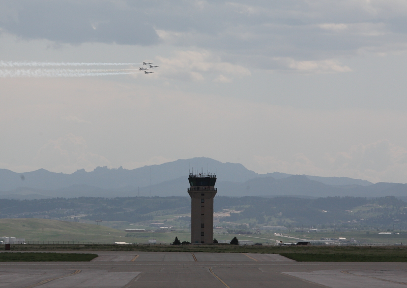
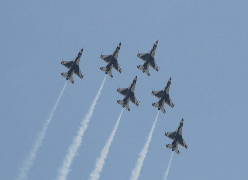
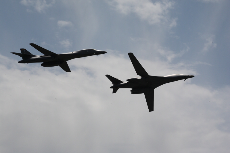
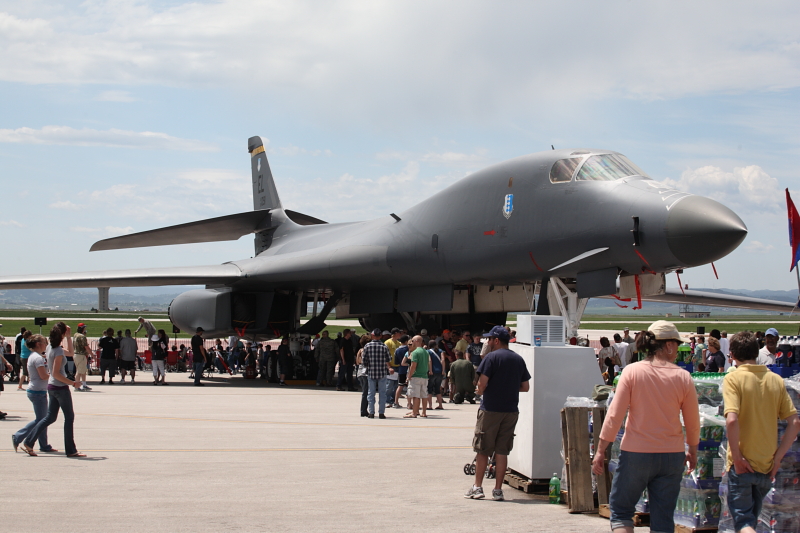
Dakota Thunder was a great airshow in Rapid City, South Dakota at the Ellsworth Airforce Base (KRCA)! I got a chance to go up there last weekend, and it was a great trip! Ellsworth Air Force Base is home of the B-1B bomber. There is also more information on Wikipedia about Ellsworth here. The Thunderbirds were there, 2 B-1Bs on the ground, 2 B-1Bs in the air, and A-10 demonstration, and lots of other stuff in the air show and on the ground to look at. And it was all free and not too crowded!

On the Ellsworth Air Force Base site, it indicates that approximately 40,000 people came to the Dakota Thunder. The area for the air show was quite large with many large planes on the ground, so it did not seem very crowded. There was also lots of food booths, so there were basically no lines for food which is fantastic for an air show. I found an article about Dakota Thunder in the Rapid City Journal here and another article about Dakota Thunder in the Rapid City Journal here.

Air Show

Thunderbirds
Grand Canyon AerialThunderbirds, Dakota Thunder

Thunderbirds, Dakota ThunderThunderbirds, Dakota Thunder

Thunderbirds, Dakota Thunder

2 B-1Bs Air Demonstration
B-1B, Dakota Thunder

A-10 Air Demonstration
A-10, Dakota Thunder


Planes, etc on the Ground

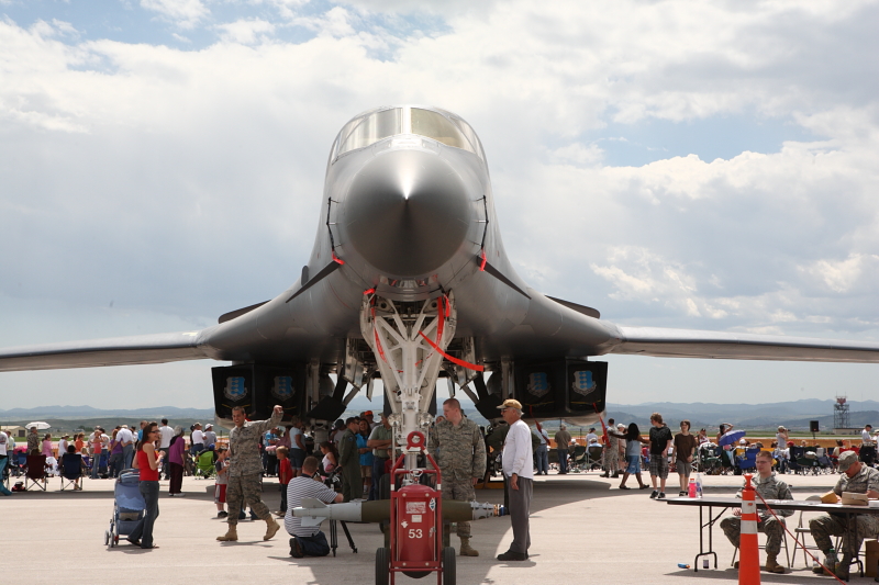
You could go inside a number of these planes and into the cockpit including the B-1B!


B-1B, Dakota ThunderB-1B, Dakota Thunder

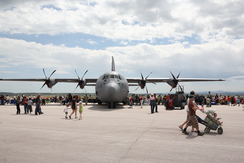
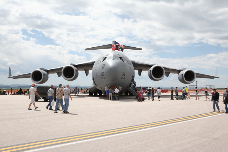
C-130, Dakota ThunderC-17, Dakota Thunder

Getting There and Back

Flying ourselves in our C182 was simple. We could basically go direct KLMO-KRAP. We flew a little west at the end to do a pass near Mt Rushmore and then landed at KRAP. If we had filled out some paperwork, we could have landing at Ellsworth Air Force Base KRCA. But I was late in checking into it, so we landed at KRAP at the Westjet Air Center, and they had a very convenient shuttle to Ellsworth Air Force Base. The shuttle bus took us right up to the flight line and enabled us to bypass the long line of cars coming into the show as well as the distance from the parking to the flight line. It was very nice.


Mt Rushmore Aerial


On the way back, it was pretty nice and smooth too. We had to dodge some thunderstorms, but the route was still fairly direct. Flying both ways and going to the air show made for a little bit of a long day, but it was reasonable and a great show. Well worth it.

Summary

Dakota Thunder is an airshow I will recommend to anybody in the area that can make it!

/Brian

Thursday, May 28, 2009

Grand Canyon Flying

Grand Canyon Aerial

Flying over the Grand Canyon is an amazing experience. Luckily, it is right on our path between Colorado and Southern California and we like going to Southern California. Navigating over the it with the special rules may sound like more hassle than it is worth, but it is pretty easy in the end if you have a GPS.

The Sectional and Grand Canyon VFR Maps

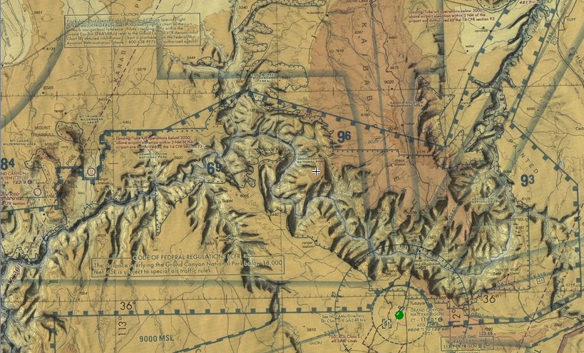
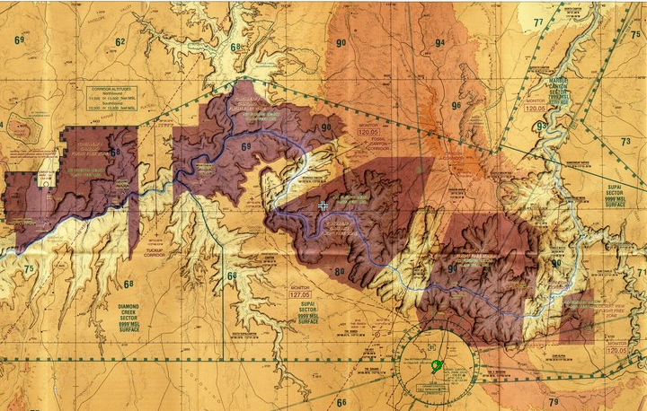
The first thing you look at is the Las Vegas Sectional, but it does not have much information on it except to avoid the entire area. Below is a snapshot. But the situation is not that bad.

Grand Canyon Sectional Piece

The next step is to buy the Grand Canyon VFR chart or at least look at it on-line with Skyvector.com. Below is a snapshot. The main areas you have to avoid are in purple unless you are at or above 14,500 MSL. If you avoid the purple areas, you can be much lower. You basically have to stay above the rim of the canyon. The altitudes you cannot go are marked somewhat similar to how it is marked on a Class Bravo area. You also should try to be at least 2000' AGL since you are over a National Park. I wish some of this information was included on the sectional chart.

The commercial traffic is allowed to go lower and below the rim. This is a little annoying that non-commercial GA traffic does not have the option, but it does separate the commercial and non-commercial traffic well. I monitor the advisory frequency of 127.05Mhz and have only heard the commercial traffic when I have flown through. So I have had no other traffic at might level while enjoying the scenery.

Grand Canyon VFR chart

The Grand Canyon Corridors

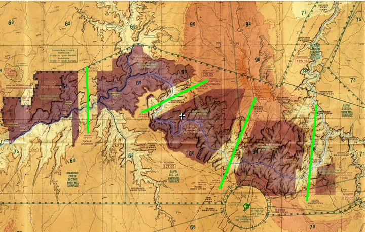
There are specific spots you can cross the canyon between the purple spots. These are labeled as the Grand Canyon VFR Corridors. I have highlighted them below with green lines. The beginning and end of these green lines are described with GPS coordinates, so it makes it easy to find the beginning and end as long as you have at least a handheld GPS. When you go across these corridors, make sure you are at the appropriate altitude for you direction on the corridor. The altitudes are marked on the map.

Grand Canyon Cooridors

Modifying My Route for the Grand Canyon

On the last trip, I need to go from Page, AZ (KPGA) to Laughlin/Bullhead, AZ (KIFP). Below is the picture of the direct route. If I looked at the sectional, I might be make a big loop around the Grand Canyon. Looking at the Grand Canyon VFR chart, it looks like I could just about make the route without crossing the purple. But I would not maximize my fun over the Grand Canyon.


Grand Canyon and PGA-IFP direct route

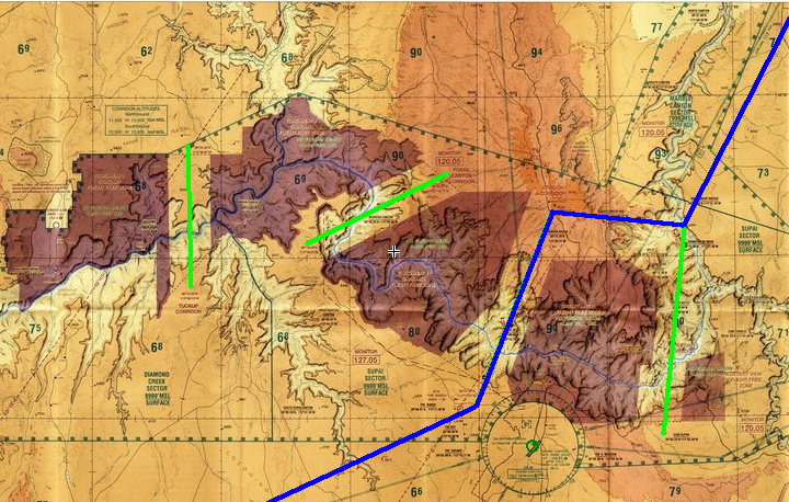
So below is what I modified the route to. See how I used the end points of the corridors to help with the path and maximize the time near the Grand Canyon. My first time over the Grand Canyon, I went over 1 or 2 more of the corridors to get more of the experience. But that was easier that time because Grand Canyon airport (KGCN) was my final destination and that was the purpose of the trip.

Grand Canyon and PGA-IFP modified route

For this trip, I first gained altitude outside the special areas to over 8000', then kept climbing over the Marble Canyon area to above 10,000', then went to the north point of the Zuni Point Corridor (36°17.38'N 111°51.04'W) then to the north side of Dragon Corridor (36°19.11'N 112°06.60'W) while climbing to maintain 2000' AGL, then through the Dragon Corridor to the south point (36°01.00'N 112°15.51'W) at either 10,500' or 12,500' for the southbound altitude, then towards KIFP. Note that there is a restricted area just south of the first westbound leg. I am not sure what it is for, but it is something to watch out for and bend your course a little north for.


Another Article

I found another article on flying around the Grand Canyon. I would recommend reading that too.

Staying at the Grand Canyon


My first trip around this area, we landed at KGCN and got a shuttle into the National Park. This worked out nicely. We stayed at one of the hotels inside the park and then took the National Park shuttles around.

Some spots I wonder about checking out in the future around the Grand Canyon that are more remote are:

Marble Canyon

Bar 10

Cliff Dwellers Lodge

Summary

Flying over the Grand Canyon is something everybody should do as a pilot. It is not that hard to plan, and it is a great experience.


/Brian

Addition:
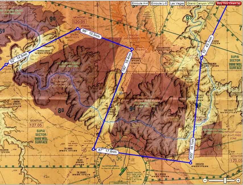
Here is another possible path I showed someone. You can't quite go direct between the points like it shows since it clips the no-fly zones, but if you fly wide in those spots it should work. I would recommend something like this for your first trip through the Grand Canyon. Remember 11500 northbound and 10500 southbound and try to maintain 2000 AGL over the North Rim.
Possible Grand Canyon VFR route

Tuesday, April 7, 2009

Disneyland Flying Trip Report

Just got back from a great flying trip to Disneyland while taking great pictures along the way. This is the trip I described in my previous Disneyland Flying Trip planning blog post. It was spring break time, my son had not been to Disneyland, and the route has a great path over many beautiful spots to photograph (Canyonlands, Lake Powell, Grand Canyon, etc).

Grand Canyon Aerial


The Trip From Longmont, Colorado to Anaheim, California

On the way out, the weather was beautiful. It has snowed a foot 2 days earlier and cleared up just in time for our trip.

The Initial Path

The direct route worked perfect. We flew klmo-allan-rlg-kege-kril-jnc-kpga (A fuel stop in KPGA), and then flew approximately kpga-kifp with diversions around the Grand Canyon corridors. We stayed the night in KIFP. We stayed at the Riverside Hotel since it has some kid friendly stuff, a good hotel price, and a free shuttle.

Grand Canyon Paths

For the Grand Canyon diversions from Page, AZ, I first went along the north side to gain altitude, then to north side of the Zuni Point Corridor (36°17.38'N 111°51.04'W) then to the north side of Dragon Corridor (36°19.11'N 112°06.60'W) then through the Dragon Corridor to the south point (36°01.00'N 112°15.51'W), then towards KIFP. All these points are on the Grand Canyon VFR chart. To view the Grand Canyon VFR chart click here at for KGCN at skyvector.com and then the Grand Canyon VFR button afterwards.

Rest of the Way

I changed the KIFP-KFUL a little from my initial plan. I initially filed and received kifp-eed-tnp-psp-v388-pdz-kful. SoCal Approach changed the clearance a number of times, but I effectively flew that same path. I might discuss that sequence in events in another post.

Using a SPOT Satellite Messager in tracking mode, I tracked my flight path and put it together below. This is a very cool service and I will talk about it more in another post. Click on the image for better detail of the path.

KLMO-KFUL short route

We used Aviation Facilities Inc (AFI) at KFUL for fuel and tie downs. Tie downs were free, and they filled up my tanks at the self-serve price as long as I pulled up to the pumps. Everybody was very friendly, and the owner even talked with me for a bit.


Good Times in California

Disneyland was great as expected.

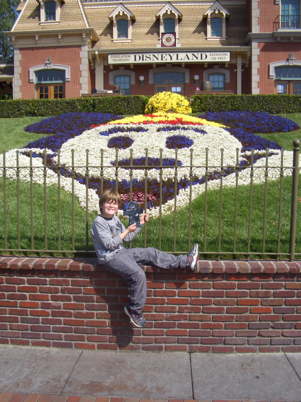
Disneyland entrance

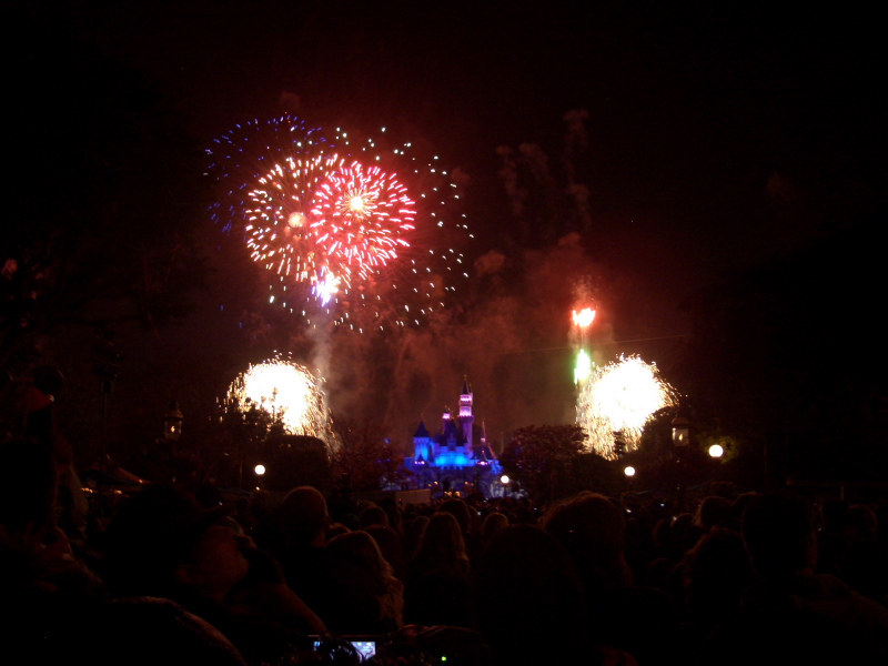
The fireworks were very impressive every night. It is amazing that they put on this show which is better than many if not most 4th of July fireworks every night. Inside Disneyland it is done nicely to music and shoots off right behind the castle.

Disneyland fireworks

We ended up staying at the Ramada Main Gate and ended up in a premium room for a little more. It had a nice bed, included a continental breakfast, nice pool, and the fireworks great from the 3rd floor. Only bad part was the TV reception was bad; it was a nice flat panel TV, but had a bad cable box. We ended up eating in Disneyland, Anaheim Garden Walk area, and Saga Pizza which was on the hotel grounds. Anaheim Garden Walk was a nice find that was within easy walking distance. It is a nice new outdoor 3-story mall area with restaurants and movies. Disneyland was an easy walk from the hotel; no complaints from my 7-year old.

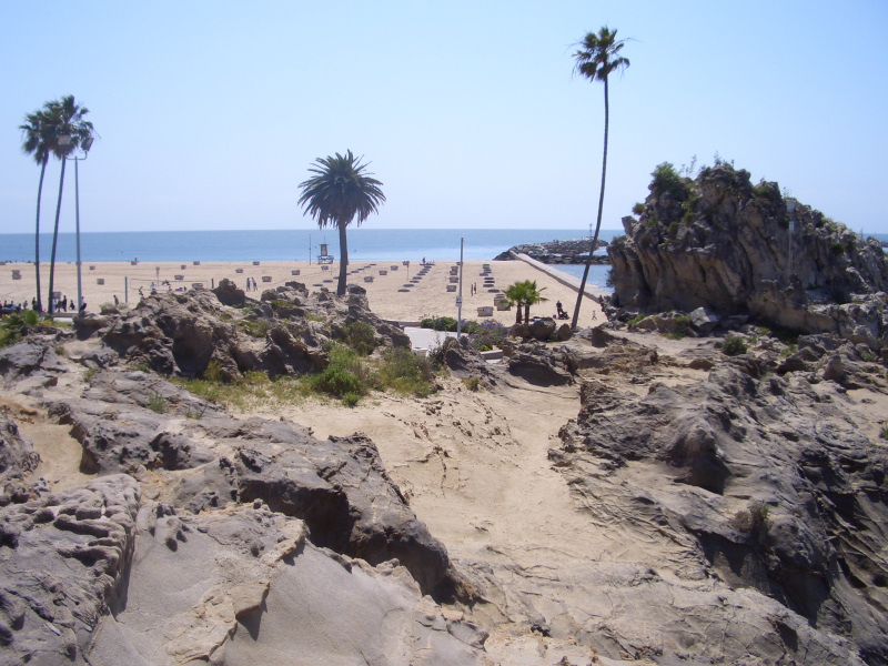
We went and visited some of the beaches after getting our fill of Disneyland, California Adventure, and the pool at the hotel. As planned we rented a car for 2 days from Enterprise; they picked us up at the hotel so it was pretty painless. One of my favorite things we found was Corina Del Mar. It is a beautiful beach area surround by pretty cliffs near Newport Beach.

Corina Del Mar


The Route Back to Longmont, Colorado


Lots of snow in the Colorado mountains, northern Arizona, and northern New Mexico changed our planned route back. We wanted to go part of the way, so we ended up with a southern route through Phoenix with a fuel stop to Albuquerque which was at the south end of the storm area. The next day we got around, under some clouds, and a short bit of IFR back to Longmont.

KFUL-KLMO long route

Path to Phoenix

We filed IFR out of KFUL. I requested: kful-sli-pdz-v388-psp-v16-pxr-kffz, but got kful-sli-v64-blh-v16-pxr-kffz. Not too bad a change. I was a little surprised at how Phoenix approach routed us way around the city to get to KFFZ.

I selected KFFZ for three reasons: It was good for the southern route I wanted, it had cheaper fuel, and there were reports of a good restaurant on the field. The reports on the restaurant were true. Ansio Landing is an awesome Italian restaurant. It is a great restaurant that you would expect in a nice part of downtown and not sitting on an airfield. Definitely not the typical greasy spoon. Check out the menu...

To Albuquerque

The next path was pretty especially the early parts just northeast of Phoenix. It looks very pretty with a canyon and a lake in the middle that I have never heard about. We need to go back there and see it from the ground. We reserved a $23/day Enterprise car rental in ABQ, but did not end up using it. We just used the shuttle to the Fairfield Inn which was a very nice place to stay; Cutter Aviation set us up with a nice rate and helped a lot with picking it out.

To Home

It looked like we could possible do kabq-saf-05v-4v1-kcos-klmo in the morning, but ended up having to switch to kabq-fti-fogle-pub-klmo due to the mountains and La Veta pass clouded in. We ended up with a short bit of IFR south of Denver to home.


Trip Highlights

  • Disneyland at an age where my son can ride everything but everything is still magical
  • Fireworks every night at Disneyland in the park or from the hotel
  • Flying over Grand Canyon
  • Beautiful area to check again north east of Phoenix
  • Ansio Landing which is a great restaurant at KFFZ
  • More time in the IFR system in the busy SoCal area

Summary

This was an excellent trip that I would recommend to others! It was a great mix of everything. A fun flight out, a fun time in California, and a chance to get my mind off of work.

/Brian

Saturday, March 14, 2009

Flying Trip to Disneyland

Our next small plane flying trip will be a trip to Disneyland for our son and a photo opportunity of the Grand Canyon and Colorado River. I found out that Disneyland is offering some cheap tickets right now, there are hotels near Disneyland for a reasonable price, and trips to California have been fun for us in the past.

For the 2009 year, Disneyland kids 4-day ticket is $164 down from $194 and till April 30th, 2009, adults get in for the price of kids ($164 instead of the normal $224). I am not sure if this is all due to the economy or if part of it is a typical spring discount. But it looks like a great deal we want to take advantage of.

I glanced at some of the hotels near the entrance other than the Disney branded ones and found that they were around $110. Maybe not fancy hotels, but will do the trick.

Time to start planning...


What Airport

So it looks like there are two airpots close to Disneyland: Fullerton (KFUL) and Orange County (KSNA). After glancing at Airnav for fuel prices and feedback from customers, it looks like the decision is Fullerton (KFUL). I also look at availability of rental cars, but I will cover that later. Then it is good to check what FBO after determining which airport. Aviation Facilities Inc seems to get plenty of good reviews on KFUL pages of Airnav.


What Route

I usually start with lookup up the direct path on Flyagogo On-line Charts. Then I compare that with looking for stops for fuel/hotel, good paths through mountains and MOAs, and the victor airways. Sometimes the victor airway are decent routes around MOAs and they also good for getting the IFR Minimum Enroute Alitutudes.

One past trip to California, there was clouds for a whole week, and I was very glad I had an IFR rating. It was just a thin layer of clouds flowing in from the coast, so it was not too difficult, but definitely not VFR. So it is definitely time to refresh my IFR rating and practice and look at my past IFR refresher blog notes.

So my first path if weather is good is: klmo-allan-rlg-kege-kril-jnc-kpga

Which is effectively one of the routes I describe in my blog post about VFR paths over the Rockies. It is also an incredible route along Colorado River, Arches, Canyonlands, and Lake Powell; a great photo opportunity. That puts a nice fuel stop and lunch break at a nice place at the edge of Lake Powell with a good price on fuel. For checking fuel prices near where I think a stop would be good, I usually use Airnav local fuel price checker.

The next path for the day is: kpga-kifp

This takes you over the beautiful Grand Canyon. Be careful to cross the Grand Canyon air spaces according to the Grand Canyon VFR chart; so you can't quite do the direct route mentioned. This path takes you approximately over Fossil Canyon Cooridor which should be flown at 10,500 or 12,500 southbound and maintaining proper altitudes over the north area. Skyvector.com has the Grand Canyon chart online.

That places at Laughlin/Bullhead (KIFP) which has been a good place for us to stop in the past. It is a casino town at the Arizona/Nevada border and also very close to California. They have a free shuttle between the airport and hotels and every time we have been able to get a hotel room which cost something like $40. Lake Havasu City (KHII) looks like an interesting possibility too.

The last bit to Disneyland: kifp-zelma-jotnu-tnp-psp-V388-pdz-wisup-kful

There is an arrival for KFUL, but I will try to avoid it if I can. The MEA for a portion of it is 13,000 and if an alternate path is taken that is slightly different, the MEA is 9500.


What Hotel

Google has a good method for checking for hotels near a location such as Disneyland. This is a also good for looking at reviews. Google also has a good method for checking for restaurants near a location.

From this it looks like there are number of restaurants right near the entrance. The kids favorite McDonalds, as well as IHOP, Mimi's, Denny's, Tony Roma's, Quiznos, and Millies (which seems to have a number of good reviews).

Expedia easier to check prices near Disneyland than Travelocity since you can select "near an attraction". You can then filter it for things like free breakfast, free parking, and free wireless internet. This and the price then narrowed my thoughts down to 3 options: Tropicana, Del Sol, and Ramada Main Gate. Around $110/day. It looks like sometimes you can get a cheaper rate by contacting the main hotel web site, so it is good to try that as well as Expedia. All have a heated pool, restaurants nearby, walking distance to Disneyland, and web site that looks pretty decent. We'll see....


Renting A Car

So with planning on being walking distance from Disneyland, I figure on just getting a taxi from the airport to start with. I found a taxi fare checker to hopefully not have surprises on the fare.
It looks like it is about $25-30 each way between the airport (4119 W. Commonwealth Fullerton CA) and the hotels (1540 S Harbor Blvd, Anaheim, CA).

For rental car starters, I checked what Enterprise has at the KFUL airport. Hmmm.. $59/day. Well that makes the taxi really make sense. So I figure there must be a better way so I kept looking.

I then discovered that Enterprise has much better deals from the local offices. I found that the Fullerton Enterprise office has rental rates of $25/day and the Anaheim Enterprise office has rates of $37/day. They also have free pickup/dropoff if you use the closest office. That won't get the cheapest Fullerton rate, but should get the Anaheim rate. I could also get a taxi to the Fullerton office and get the cheap rate if it makes sense. It will probably depend on how many days I plan to rent for. It is nice to see some nicer priced options that are also pretty convenient.


Summary

Well I think that wraps up the important details other than packing and going. We'll see how it goes. Anybody have suggestions??

/Brian

Tuesday, August 19, 2008

West Yellowstone Airport Camping


As part of our Idaho and Yellowstone airplane camping trip, we stayed at West Yellowstone, MT(KWYS). I have been talking about it in my past blogs about a future Yellowstone flying trip and general airplane camping thoughts. This was the first time I had been there, but I have heard many people describe it as a great place to visit with a nice campground.

The Campground

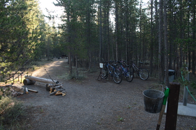
We flew in at sunset and the FBO had closed, so we had to wander around to find the campground area. Luckily, it was fairly well marked and my Flight Guide had its location correct. It is located at the northeast end of the main ramp area a little away from the commuter and FBO traffic. When you find the area and sign in the picture below, you know you have found it.

The campground area is very nice, and it is free after you have paid for the overnight parking. It is only available to pilots, so it has a lot more availability than other Yellowstone campgrounds. I hear it can be busy over the weekends, but we had the place to ourselves. The nearest sites are just inside the trees, and there are more sites going back. There are fire pits, lots of firewood, a funky (but working) hot shower, an acceptable pit toilet, picnic tables, lots of flat space for tents, and drinking water. For a nice toilet, you can always go over to the terminal a little walk away. There are even a number of bicycles including a smaller girls bicycle available for use by pilots. Another nice item is the trailer to cart your stuff between your plane and your campsite.


The FBO

The Yellowstone Aviation FBO is currently at the south end of the main ramp area in the terminal, although it is relocating to a cabin in the middle of the ramp area soon. Be careful walking to the terminal on the ramp since it has commuter airlines and NTSB controlled access. Better to go through the fence and go through the normal passenger entry. I have seen this at other airports, so I knew to be a little careful in the ramp area.

Getting a rental car... Both Avis and Budget there. With an AOPA discount, the Budget rental ended up being just over $50/day after taxes.

The FBO people were super friendly. They watched over my son while I got the rental car and offered him free food and toys they happen to have around. Maybe they were being nice to a father/son outing, but I think they were just genuinely nice too. Their fuel price was high, but they tried to make up for it in service.

There is a decent restaurant on the field as well. This is certainly convenient if you get lazy about cooking for yourself at your campsite. There are plenty in town as well which is not far away.

Yellowstone

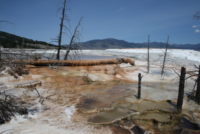
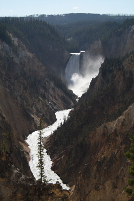
There is so much to see of Yellowstone National Park. The main roads in Yellowstone form a figure 8 of sorts. We had seen Old Faithful in the past which is part of the lower loop, so we decided to try the upper loop of the park. It had the Paint Pots, Mammoth Hot Springs, Grand Canyon of Yellowstone, and more wildlife potential. In the end, we did not see much wildlife, but we were mostly driving around during the main daylight hours of the day. The upper loop did take most of the day, and we did not stop at everything.


There is a new visitor center in the Canyon area of Yellowstone. It is a pretty nice visitor center, so I would recommend giving it look if you are near there.

My son still really wanted to see Old Faithful again, so we will definitely have to go back. Of course he told me this after we were half way around the loop. We saw the Old Faithful area from the air, so that made him happy for this trip.

The Town of West Yellowstone

We did not get a chance to look around West Yellowstone too much, but it seemed like a nice town. There are two links I found for the future: a general link on West Yellowstone and a good link from the West Yellowstone Chamber of Commerce.

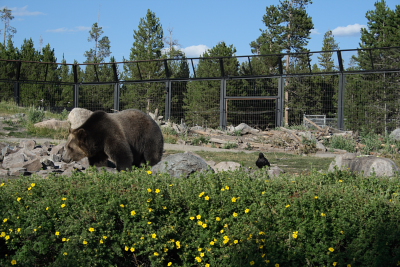
One thing we did visit that was recommended was the The Grizzly & Wolf Center. It is kind of a mini zoo for Grizzlies and Wolves and also a place to make people more informed about camping around grizzlies and wolves. It is brand new, expanding still, and quite nice.

There is a kid feeding time for the grizzlies which is kind of neat. No... not feeding kids to grizzlies. It happens once in the morning and once in the afternoon. They close the grizzlies out of the main closure and in a very organized way bring kids in to hide berries under rocks all over. Then the kids leave and the bears are allowed back in. It was pretty cool.


Flying Back

The trip along the Tetons on the way there or back is quite impressive. We also did fly over Old Faithful which was fun. I have seen some impressive aerial pictures of other places in the park that hopefully next time we will see from the air.

Teton National ParkSummary

West Yellowstone airport is a great place for visiting Yellowstone and good camping. It has a nice long, paved runway so any pilot can make it into this one. We were here by ourselves this time, but I hope to get other families to join us next time.

/Brian

Monday, August 18, 2008

Big Creek Airstrip and Camping

Big Creek Airstrip looking northAs part of our Idaho and Yellowstone airplane camping trip, we stayed at Big Creek, ID (U60). I have been talking about it in my past blog about general airplane camping thoughts, and I wrote about it in my past blog entry when I took the McCall Mountain/Canyon Flying Seminar. This was the first time I had both landed and stayed there. It was a very nice location.

There is a lodge as well as camping so we would have a choice for dinner and sleeping. Our plan this time was to camp. We also met up with another family during our stay here and had a great time.
The Approach

Big Creek is a more challenging strip to get into, but not as hard as some. I would recommend looking at the Fly Idaho Book for details. From the south, I flew past Stanley, Sulfur Creek, Landmark, and Johnson Creek airstrips. After passing the ridge before Big Creek, I started desending and quickly saw the airstrip. I circled the airstrip in a typical pattern and at the typical altitude, announcing on 122.9 what I was doing. I did a standard left hand pattern entry and landing to the south which is upstream. The altitude is 5743' and the landing is made uphill; takeoff is downhill. I recommend taking instruction before landing here. I would not have wanted to do this without it.
It is not recommended to land or takeoff the opposite directions. We saw somebody land the wrong way, and he took the entire runway; the airport manager said he had seen it done 3 times and this was the first without an accident. Also, if the wind is blowing the wrong way for takeoff, wait until later. We saw somebody takeoff uphill and into the wind; he made it, but the airport manager strongly warned against it. You may get off the ground and up to treeline and then end up losing the wind and sinking into the trees.

When we were there, the wind was calm in the morning and then picked up around 10:30am from the South. 12:00pm is typical. It did not die down until around 7pm. On our departure day, we ended up waiting until 7pm to get the proper winds. Sunset was around 8:45pm, so we still had time to make it to our next destination.

With proper instruction, this airstrip is not bad and is a lot of fun.


Big Creek Airstrip looking south


Parking

Parking is at the South end of the strip on the east side. There are a couple things to be careful of. The tie downs stick up out of the ground, so you might not want to taxi over them, but in front of them. The parking is also slightly downhill. So after engine shutdown, somebody either has to hold the brakes while somebody gets a rock or use the parking brake. Then slowly back the plane down to the tie downs and put a rock under a wheel.

The Campsite

The campsite is right behind the airplane parking. There are fire pits, picnic tables, lots of flat space for tents, drinking water, and a decent pit toilet. Lots of nicely spaced trees for hammocks. There is a fun small creek to play in for the kids. Very pretty location. Since the road access is a long dirt road through Yellow Pine, this location is pretty quiet except for the occasional plane. I think the nearest big town is McCall which Google estimates as 4.5 hour drive. McCall is less than 30 minutes by plane.


Big Creek Campsite
The Lodge

There is a nice lodge here at Big Creek. There they have lodging, a restaurant, horseshoes, and a campfire in the evening.

They have a nice restaurant. The restaurant does not have a standard menu, but cooks a good standard breakfast, lunch, dinner for the people there. We made it to breakfast twice and it was very good and very filling. For dinners, they check with who will be eating and try to make something everybody will enjoy.

The lodge was very nice to us even though we were just camping, but we did eat a couple meals there to be somewhat a part of the lodge. The hospitality is impressive and I would recommend checking it out for at least meals if not staying there.

There was an evening campfire that was a highlight of our trip. The lodge started it up around 7:30pm and we all enjoyed. We brought some marshmellows and somebody had a guitar. It was very nice.

Things Nearby

We only saw a few things while we were there, but I think the area has a lot to offer. Although just hanging out around the airstrip was very nice.

We wondered about going down to see Big Creek itself. It is a bit of a walk, so we asked the lodge if they could help us out with a ride at least in one direction. They found a convenient time and gave us a ride in a truck down to the trail going to the Big Creek and the half moon outhouse. From the trail it was a pretty easy walk down to the river. Maybe 1/2 mile? Then we probably had 1.5 miles back to the campground. It was a nice time.


Big Creek


The family I met up with had mountain bikes and the lodge has mountain bikes for rent for $10/day. This is a fun thing to do since the dirt roads do not have much car activity and there are old mines to look at and it is just a general pretty area.

There is a horse barn for the USFS there as well. Nobody was at it the first day, so we stayed away. But the second day, some people were there and we asked if we could come visit. It was a convenient time for them, so they gave us a nice tour. A great time for a 6 year old.


Horses near Big Creek

Summary


It is definitely a place I want to go back to. If my wife comes along, we will likely stay in the lodge. If it is just another father/son trip, we will probably do the camping again. Both are very nice.

/Brian